

CAMINO KRK ROUTE – about 150 km long
Following in the tradition of Croatian Confraternities of St. James that have been helping pilgrims on their way to Santiago de Compostela since 1203, the Croatian Confraternity of St. James has started with the revitalization of medieval pilgrimage routes leading to Santiago de Compostela.
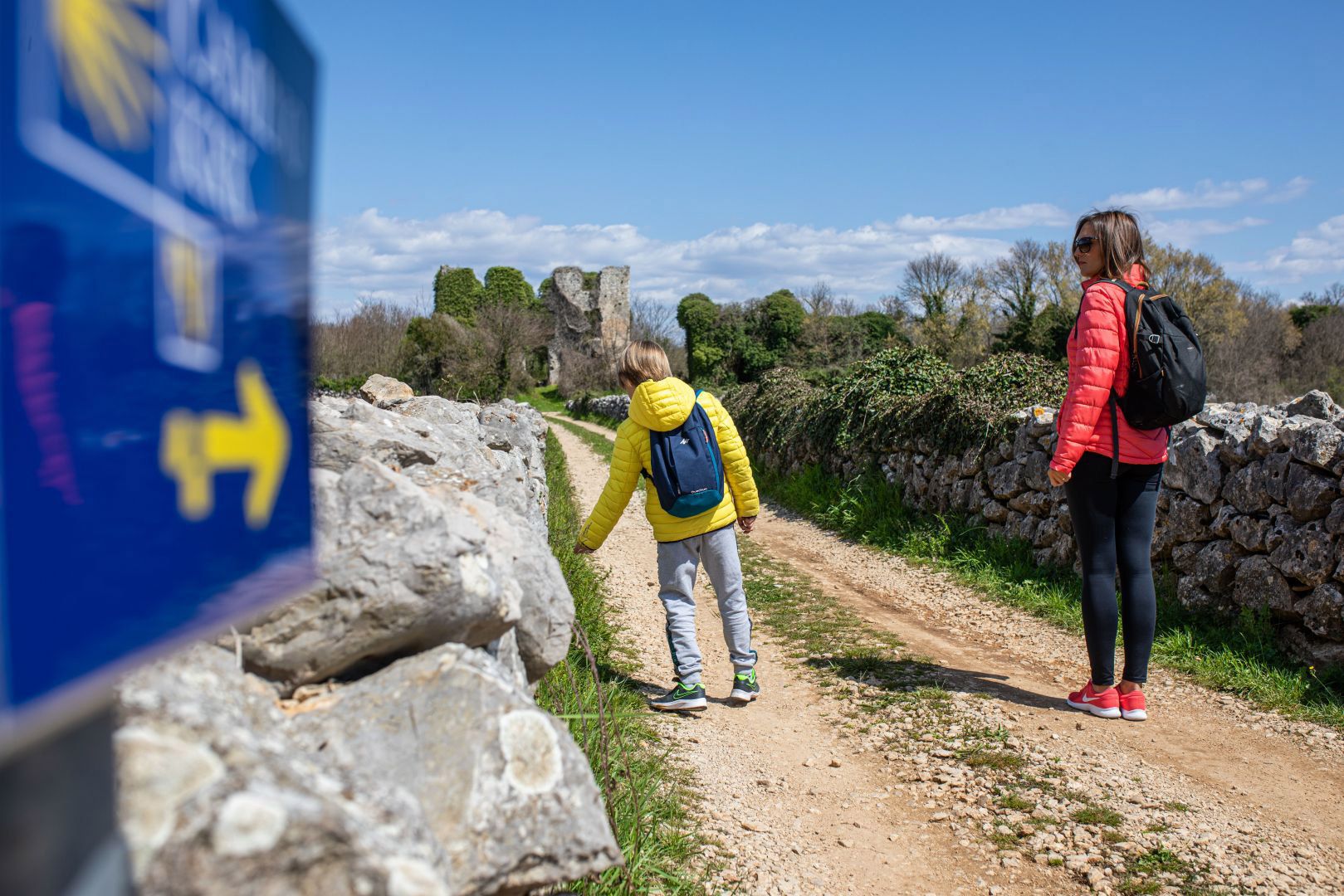
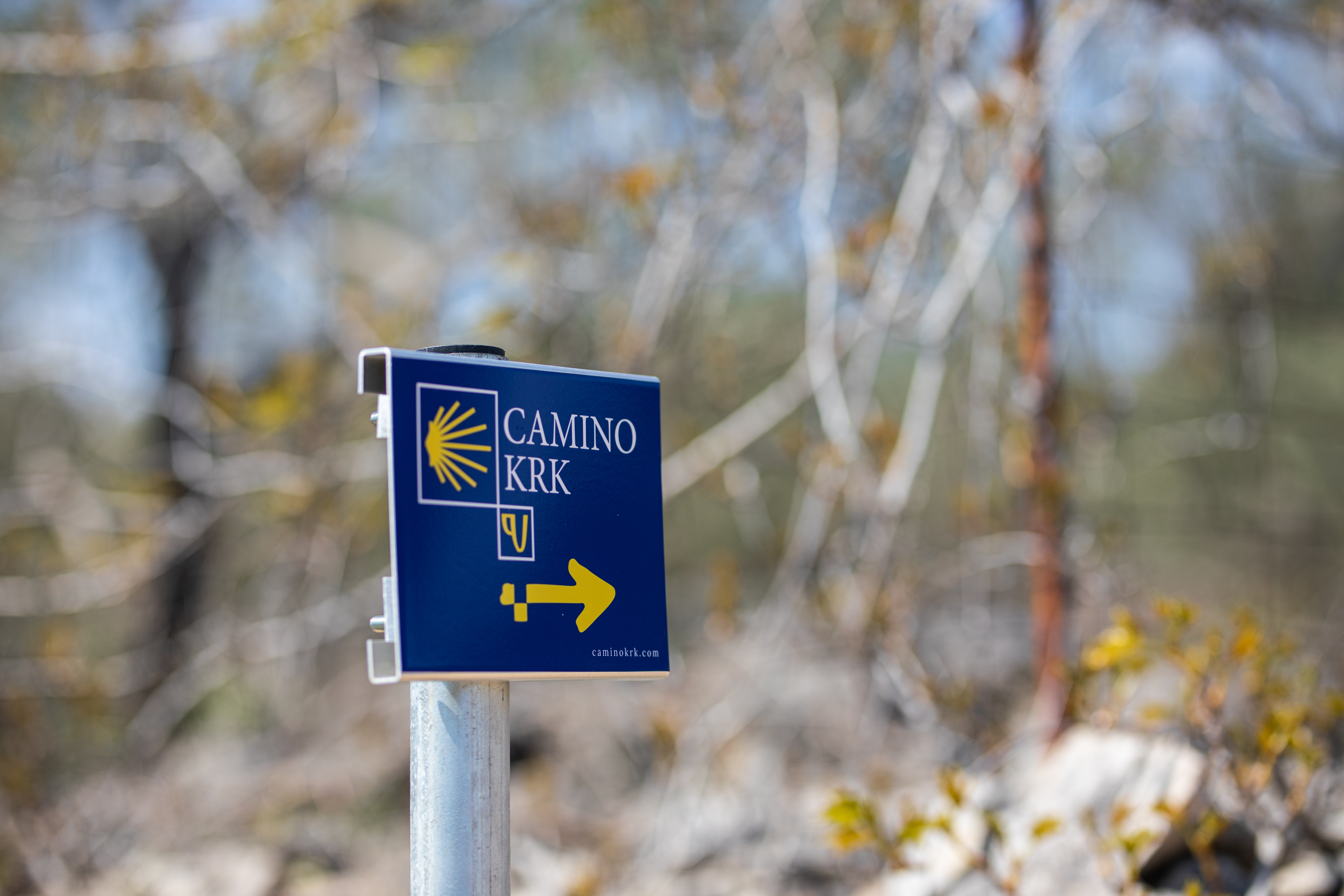
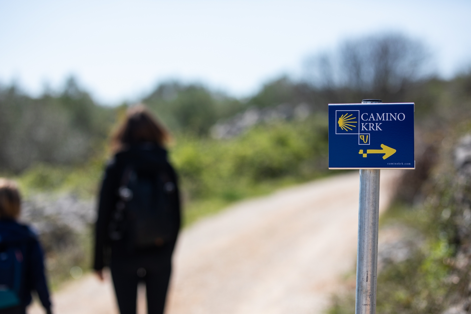
The island of Krk has been chosen as the first section of the Croatian Camino route to be officially marked with yellow arrows (customized with a Croatian traditional symbols). Official Croatian credential (pilgrim passport) with Camino stamps reflecting the local cultural heritage is available for all pilgrims who like to discover this new addition to European network of Camino routes.
The Camino Krk Route is about 150 km long, with recommended itinerary below.
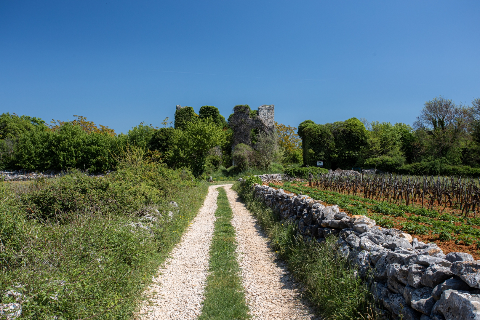
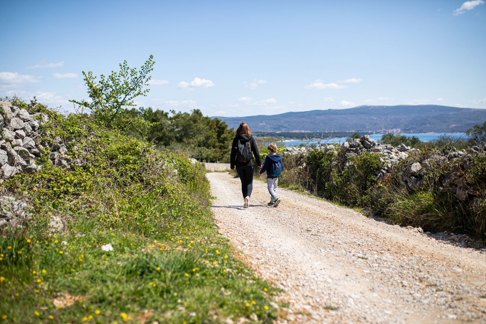
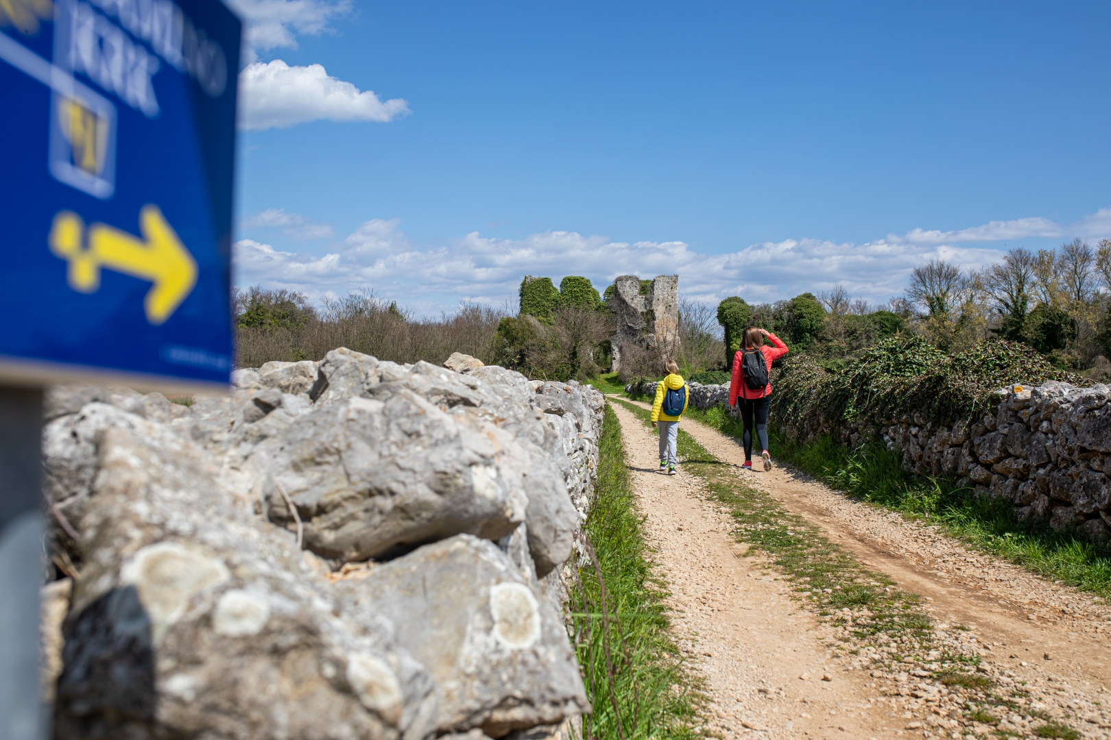
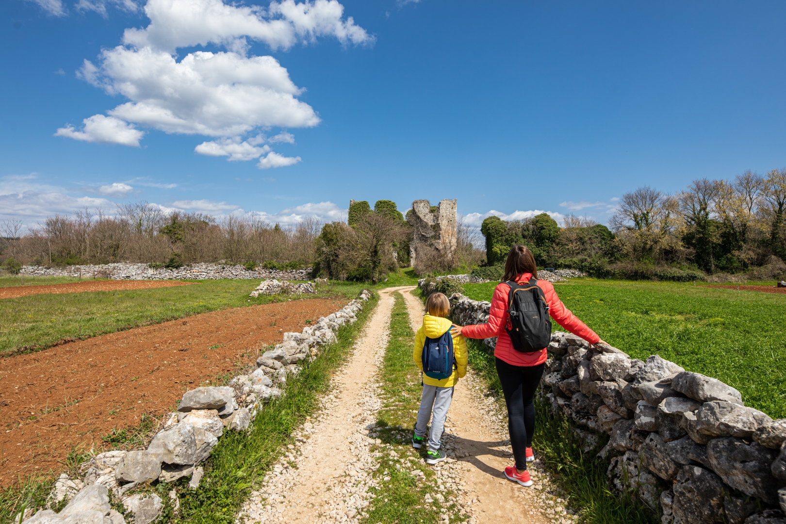
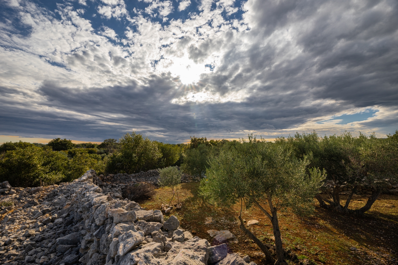
Spectacular natural scenery, forests, hills with amazing view, old castles and churches, abandoned villages, small medieval town, gorgeous beaches are just a part of what is has to offer. Each day offers a unique opportunity to find inner peace, a chance to reflect, to discover that special kind of “Camino experience”. Buen Camino!
Seven days of pilgrimage tour with getting to know the sights of the island of Krk:
Day 1 KRK – BRZAC (23 km)
Section length: 22.7 km / Overall ascent length: 564 m / Overall descent length: -436 m
The highest elevation: 232 m
The lowest elevation: 1 m
The average walking time: 5:00 h – 6:00 h
Type of terrain: asphalt, macadam road, forest path
The Camino Krk route starts from the town of Krk, the island’s centre, with the first day featuring a 23-kilometre long walk through its surrounding villages, from Vrh through the Šotovento area, Skrbčići and Pinezići all the way to the village of Brzac. Aside from the stunning nature, pilgrims will have the opportunity to admire the island’s impressive historical, cultural and religious heritage. The pilgrimage starts at the heart of the Krk’s old town, boasting a complex of the Cathedral and the dual Church of St Quirinus and St Margaret by Kamplin Square as a prime example of the island’s religious architecture. After visiting the Frankopan Castle, the Krk residence of the noble family of historical relevance for the country, the old town alleys pass by the Krk Island Maritime Heritage Interpretation Centre and lead all the way to the Upper Town Gate that guards two valuable complexes, the Franciscan Monastery and the Benedictine Convent, along with Our Lady of Good Health – the town’s first Romanesque church. The next pilgrimage point is the so-called Salatići Castle, from where the path runs by the Kimpi and Kaštel fields and reaches Vrh, a village dominated by the Parish Church of St Michael the Archangel, before taking us further to the neighbouring Skrbčići and Pinezići. Passing through Šotovento, a fertile wooded part of the island that covers the area around St Fusca Cove, walkers will be drawn to the remains of the Kambun settlement, while the first day’s tour ends with a visit to Vela Jana Cove and the village of Brzac.
Day 2 BRZAC – MALINSKA (23 km)
Section length: 22.9 km / Overall ascent length: 452 m / Overall descent length: – 585 m
The highest elevation: 137 m
The lowest elevation: 1 m
The average walking time: 6:00 h – 7:00 h
Type of terrain: asphalt, macadam road, forest path
Day two of the pilgrimage includes a 22.9-kilometre long walk from the village of Brzac to Glavotok, still in the Šotovento area, before heading to Dubašnica. Passing through several authentic island villages, this part of the route ends in Malinska, the centre of the Malinska-Dubašnica Municipality. After leaving Brzac, the path heads towards Glavotok, a hamlet first mentioned as a summer residence (with a chapel) of the Frankopan Counts of Krk. In the 15th century the chapel was donated to the Franciscans, who built a monastery and later a church on the estate. The dense forests surrounding Glavotok lead to the Church of St Chrysogonus above Čavlena Cove, a true gem of the island’s Romanesque architecture. Later on, pilgrims will come across the island’s biggest and oldest oak tree.
A stroll by the sea and partly through the forest leads to the viewpoint in the Fumak area, followed by the village of Porat developed around the Franciscan monastery – a complex comprising a museum, an olive mill (called toš by the locals) and a collection of church artwork and exhibits testifying to the religious, cultural and economic heritage of the Third Order Franciscans in Porat. The monastery’s Glagolitic lapidarium houses copies of Croatia’s oldest and most important Glagolitic inscriptions. On the way through Dubašnica walkers will see the Old Cemetery of St Apollinaire with an impressive stone bell tower. The path further leads through several villages, from Sveti Anton and Milovčići to Kremenići with the Chapel of St Andrew, the oldest preserved chapel in the area. The Camino story’s second chapter ends in Malinska.
Day 3 MALINSKA – OMIŠALJ (19 km)
Section length: 19 km / Overall ascent length: 371 m / Overall descent length: – 294 m
The highest elevation: 83 m
The lowest elevation: 0 m
The average walking time: 4:00 h – 5:00 h
Type of terrain: asphalt, macadam road, forest path, beach
Third day, the pilgrimage resumes along a 19-kilometre long route from the heart of Malinska to the northern part of the island, west of Kijac and through Njivice, to Omišalj as the final destination. To reach Kijac Cove, we will take a nice stroll through the Paradise Trail seaside promenade. Upon arrival to Njivice, we will visit the Church of the Nativity of the Blessed Virgin Mary built in the early 20th century in the place of earlier religious buildings. In the ancient era, this tame area known as Poje was home to a rustic villa, a large farming estate on which an early Christian church was later built. The path leads us further north to the Mohorov site with the remains of another late Antiquity dwelling. A stroll towards Sepen Cove, south-west of the town of Omišalj, will take us to the remains of the Roman town of Fulfinum from the first half of the 1st century and to a valuable monumental early Christian church with a cross-shaped layout, belonging to a late Antiquity necropolis at the Mirine site, built in the early 5th century. The path through the woods to an elevated site above Omišalj Bay leads us to Fortičina, where the ruins of a medieval castle and a late Antiquity fortress with a cistern were found. Descending to the coast by Pesja Cove, we will reach our next destination – Dubec Park, a landscape architecture site from the first half of the 20th century. Upon entering the very heart of Omišalj, pilgrims will be drawn to the picturesque Church of St Helen and the Romanesque Parish Church of the Assumption of the Blessed Virgin Mary.
Day 4 OMIŠALJ – ČIŽIĆI (21 km)
Section length: 21 km / Overall ascent length: 343 m / Overall descent length: – 419 m
The highest elevation: 103 m
The lowest elevation: 0 m
The average walking time: 5:00 h – 6:00 h
Type of terrain: asphalt, macadam road, forest path, sandy beach
On day four, the pilgrimage section follows a 21.4-kilometre-long, northernmost route from the centre of Omišalj to Čižići. It starts from the viewpoint of Dubec Park, Omišalj’s green oasis, with a nearby single-nave Romanesque church dedicated to St Anthony of Padua. A pleasant walk to the northern tip of the island continues near a scattered village and the coast, i.e. the coves of Večja, Martinj and Lučica. Passing along the southern edge of Omišalj Campsite, the route reaches the intersection for Rijeka Airport and climbs up through sparse vegetation to the Krk Bridge, very close to the barren islet of Sveti Marko. At this point, the pilgrimage route descends to Voz Cove and the Vošćica peninsula where you can see the foundations of an ancient building and the Maltempo Fort, built by the Venetians to control maritime traffic in the channel of Tihi kanal. In an elevated area known as Kapelica, located between the coves of Voz and Peškera, i.e. Cape Bejavec and Tihi kanal, walkers will find a watchtower and the remains of a long building with a side entrance. Close by is also an eco-friendly immortelle field. A long walk along the rocky north-eastern coast by the Vinodol Channel will take you to Slivanjska Cove, boasting one of the most beautiful sandy beaches on the island. Biserujka Cave, situated right in between the cove and the village of Rudine, is known for a vast array of cave decorations – calcite speleothems, especially columns and stalactites. In the Municipality of Dobrinj, the pilgrimage route passes through Rudine and a woody area in the direction of Čižići. The last section of day four will bring you to the remains of St Peter’s Church.
Day 5 ČIŽIĆI – VRBNIK (21,6 km)
Section length: 21.6 km / Overall ascent length: 623 m / Overall descent length: – 590 m
The highest elevation: 266 m
The lowest elevation: 0 m
The average walking time: 5:00 h – 6:00 h
Type of terrain: asphalt, macadam road, forest path
Along the 21.6-kilometre route, the pilgrimage continues from Čižići via Soline and a woody inland area to the villages of Dobrinj and Sv. Vid Dobrinjski. It ends in Vrbnik, which you will reach from Risika. A coastal promenade connects Čižići with the neighbouring village of Soline, both situated in the shallow and warm Soline Cove. Between them lies Meline, a coastal area known for black medicinal mud. On the sheltered hill above Soline, one of the oldest settlements of the Dobrinj area, walkers will find a single-nave Romanesque church of Ss Philip and James. The route then climbs up through thick woods towards Dobrinj, the centre of the eponymous municipality, adorned by the St Steven’s Parish Church. A prominent Baroque bell tower and the Holy Trinity Church are located not far from the parish church, where the old cemetery lies. After visiting Dobrinj and a short walk by the side of the road, the next pilgrimage point is located at the entrance to the nearby village of Sveti Vid Dobrinjski. This single-nave and single-apse church dedicated to St Vitus is unique for its massive stone bell tower built in front of the entrance façade some time later. Farther ahead are the remains of Dolovo (or Dolova), an abandoned village between Kras and Gostinjac. The route continues in the direction of south-east, taking you to the Vrbnik Municipality and Gradec, a castle hidden in the forest also known as Fort Rovoznik, the first estate of the Krk’s noble family of Frankopan. From the pleasant village of Risika, the route diverges to the coast again, where, in the middle of a small peninsula in St Marek’s Cove, you will find the remains of St Mark’s Church. Passing along the coast and through the forest, it leads all the way to Vrbnik, the most picturesque island settlement located above the sea, at the very top of a steep cliff. The Parish Church of the Assumption of the Blessed Virgin Mary dominates its old town, which boasts many other religious buildings as well as noteworthy sites such as Klančić, the narrowest street in the world, the Vitezić’s family library, or the remains of medieval walls – one of many traces left in Vrbnik by the Krk’s noble family of Frankopan.
Day 6 VRBNIK – BAŠKA (23,3 km)
Section length: 23.3 km /Overall ascent length: 730 m /Overall descent length: -756 m
The highest elevation: 397 m
The lowest elevation: 13 m
The average walking time: 5:00 h – 6:00 h
Type of terrain: asphalt, macadam road, forest path
On day six, the walk continues through the Vrbnik Field on a 23.3-kilometre-long section from Vrbnik to Baška. The field is widely known as the place where precious vines have been grown for more than a hundred years now. The route will then take you to the source of Vela Rika and the nearby climbing sites of Portafortuna and Belove stene in the Baška Municipality, an area perfect for a wide range of outdoor activities. Nearby you will also find an impressive landscape with dry stone walls (’gromača’) leading to the so-called Moon Plateau. This otherworldly place is the most famous local site due to its barren landscape without any shade, resembling a rocky desert or the Moon’s surface. North of the Moon Plateau you will find Kuntrep Ornithological Reserve stretching from Cape Glavine to Mala Luka Cove – the oldest ornithological reserve in the world, where griffon vultures are taken care of. The Moon Plateau is connected to Baška by the Path to the Moon. Its first section goes through the woods and takes you to the Church of St John the Baptist, patron saint of the parish and the Baška Municipality. The Path to the Moon
continues downhill towards the centre of the village, boasting another three significant religious buildings: the Parish Church of the Holy Trinity, the Church of St Anthony of Padua, and St Mark’s Chapel, underneath which lie the remains of a monumental Early Christian basilica and a baptistery. Given that the Glagolitic script is one of the symbols of the Baška area, make sure to take the Baška Glagolitic Trail featuring 34 stone sculptures of the Glagolitic alphabet, erected on attractive sites in Baška, Jurandvor, Batomalj and Draga Bašćanska.
Day 7 BAŠKA – KORNIĆ (21,4 km)
Section length: 21.4 km / Overall ascent length: 779 m / Overall descent length: -709 m
The highest elevation: 569 m
The lowest elevation: 0 m
The average walking time: 6:00 h – 7:00 h
Type of terrain: asphalt, macadam road, forest roar, rocky karst
On day seven, a 21.4-kilometre-long section will take walkers from Baška via Jurandvor, Batomalj and Punat to the final destination – Kornić. Following the sculptures along the Baška Glagolitic Trail you will arrive in Jurandvor, one of the most famous sites on the island. What made it famous was an artefact found in 1851 in the abbey complex of St Lucy. It is a stone slab of the altar partition known as the Baška Tablet, one of the oldest historical monuments of the Croatian history, i.e. literacy and sovereignty. The route continues to the west and takes you to Batomalj. Above the village, you will find not only the largest diocesan Marian shrine, but also one of the oldest Croatian shrines. The next climb towards the south-western plateau brings you up to a restored ‘mrgar’ called Lipica and a road with sparse roadside vegetation leading to Obzova and Veli vrh. From there you will be able to see the islet of Košljun, and Kornić, pilgrimage points along the way. Along the path to Punat, the centre of the eponymous municipality, you will see the Stations of the Cross. The Toš Gallery and Stari Toš Olive Growing Interpretation Centre are well worth visiting, along with the Parish Church of the Holy Trinity and two votive churches dedicated to St Rocco (at the main square) and St Nicholas in Buka. Located at the heart of the picturesque bay of Puntarska draga, the islet of Košljun is a true spiritual oasis, covering only 0.072 square kilometres and welcoming pilgrims that come here by boat every day. A thick forest of centuries-old holm oak and black ash trees hides a Franciscan monastery with a lavish Renaissance church dedicated to the Annunciation of the Blessed Virgin Mary. A museum with a rich holding of ethnographic, archaeological and religious artefacts, and a library with more than 30,000 books also make part of the monastery. On the way to the last pilgrimage point, walkers will get to know another two attractions: the archaeological site in Kanajt and the remains of a trefoil Romanesque church dedicated to St Donatus. The Camino Krk route ends in the town of Krk area, with the last pilgrimage point being the Parish Church of St James the Apostle.
Pilgrim passport and stamps
ARRIVA VALUE FOR MONEY- all pilgrims who book and pay accommodation for a minimum of 3 nights - receive a CAMINO KRK pilgrimage passport as a gift.
Pilgrim passport for Camino Krk, is issued by the Croatian Confraternity of St. James. It tis officially certified by the Pilgrim Office at Santiago de Compostela, and is valid for all pilgrimage routes on the Way of St. James in Europe.
You can collect stamps for your pilgrim passport (credential) on various locations along the Camino Krk route.
Most of the pilgrim stamps feature Glagolitic alphabet, crested in the 9th century. The Croats were the only nation in Europe given special permission by the Pope their own language and this script in liturgy.
All pilgrims who complete at least one daily section of the Camino Krk route are eligible for Camino Krk Compostela – pilgrim certificate.
All you need to do is present your stamped pilgrim do passport at the tourist office in the city of Krk and they will issue you our Compostela free of charge.
GPS trail of the route
We recommend using the GPS trail of the route.
Also, the starting and ending point of the route (Krk and Kornić) will be adorned with multilingual info boards. In addition, precise descriptions of each of the seven pilgrimage days have been made, with special emphasis on the island's natural, historical an d cultural heritage with multilingual summaries which, together with a digital, share-based map, will be presented on the website Camino through Croatia: caminocroatia.com.
In addition to signaling, the route can be tracked using a smartphone with a GPS file, thanks to the Maps.Me application created for the Android and iOS (Apple) platforms.
Afteinstallation, it is necessary to open an interactive map available on the website caminocroatia.com on your mobile phone and download the GPS file of the route.
After downloading and running the subject file, the route opens in the Maps.Me application (which can also be used offline, but only if the map of Croatia is previously loaded into the application).
CAMINO ACCOMODATION – TOWN OF KRK
PRIVATE ACCOMODATION MILA
House is located in the town of Krk, on the start of Camino Krk route, cca. 400 m centre of town and cca. 500 m from the nearest beach.
All accommodation units have free Wi-fi, air conditioning, bed linen and towels, free parking place available in the yard.
Check-in: 3.00 pm Check-out: 10.00 am
Type of accomodation:
M2:1st floor, Double bedroom with double bed, balcony with outdoor furniture and sea view, bathroom with shower, cable TV, refrigerator, air conditioning
ML1: 1.floor, Apartment studio; bedroom with double bed, kitchenette, dining area, bathroom with shower, terrace with sitting, air conditioning
M1: 1.floor, Studio apartment with seaview; living- sleeping area with double bed, kitchenette with dining area, bathroom with shower, terrace with sitting, air-conditioning
M3: Triple bedroom with double bed and single bed with sea view, refrigerator, cable TV, bathroom with shower, terrace with sitting, refrigerator, air conditioning
M5: 2.floor, Apartment for 4 people; 2 bedrooms with double bed, bathroom with shower, large terrace which is shared with another apartment with outdoor furniture, equipped kitchen, cable TV
M6: 2.floor, Apartment for 4-5 persons, 1 bedroom with double bed, 1 bedroom with double bed and single bed, bathroom with shower, large terrace with sea view which is shared with another apartment with outdoor furniture, equipped kitchen, cable tv
Price for unit per night:
For stays shorter than 4 nights + 30%
Following in the tradition of Croatian Confraternities of St. James that have been helping pilgrims on their way to Santiago de Compostela since 1203, the Croatian Confraternity of St. James has started with the revitalization of medieval pilgrimage routes leading to Santiago de Compostela.
The island of Krk has been chosen as the first section of the Croatian Camino route to be officially marked with yellow arrows (customized with a Croatian traditional symbols). Official Croatian credential (pilgrim passport) with Camino stamps reflecting the local cultural heritage is available for all pilgrims who like to discover this new addition to European network of Camino routes.
The Camino Krk Route is about 150 km long, with recommended itinerary below.
Spectacular natural scenery, forests, hills with amazing view, old castles and churches, abandoned villages, small medieval town, gorgeous beaches are just a part of what is has to offer. Each day offers a unique opportunity to find inner peace, a chance to reflect, to discover that special kind of “Camino experience”. Buen Camino!
Seven days of pilgrimage tour with getting to know the sights of the island of Krk:
Day 1 KRK – BRZAC (23 km)
Section length: 22.7 km / Overall ascent length: 564 m / Overall descent length: -436 m
The highest elevation: 232 m
The lowest elevation: 1 m
The average walking time: 5:00 h – 6:00 h
Type of terrain: asphalt, macadam road, forest path
The Camino Krk route starts from the town of Krk, the island’s centre, with the first day featuring a 23-kilometre long walk through its surrounding villages, from Vrh through the Šotovento area, Skrbčići and Pinezići all the way to the village of Brzac. Aside from the stunning nature, pilgrims will have the opportunity to admire the island’s impressive historical, cultural and religious heritage. The pilgrimage starts at the heart of the Krk’s old town, boasting a complex of the Cathedral and the dual Church of St Quirinus and St Margaret by Kamplin Square as a prime example of the island’s religious architecture. After visiting the Frankopan Castle, the Krk residence of the noble family of historical relevance for the country, the old town alleys pass by the Krk Island Maritime Heritage Interpretation Centre and lead all the way to the Upper Town Gate that guards two valuable complexes, the Franciscan Monastery and the Benedictine Convent, along with Our Lady of Good Health – the town’s first Romanesque church. The next pilgrimage point is the so-called Salatići Castle, from where the path runs by the Kimpi and Kaštel fields and reaches Vrh, a village dominated by the Parish Church of St Michael the Archangel, before taking us further to the neighbouring Skrbčići and Pinezići. Passing through Šotovento, a fertile wooded part of the island that covers the area around St Fusca Cove, walkers will be drawn to the remains of the Kambun settlement, while the first day’s tour ends with a visit to Vela Jana Cove and the village of Brzac.
Day 2 BRZAC – MALINSKA (23 km)
Section length: 22.9 km / Overall ascent length: 452 m / Overall descent length: – 585 m
The highest elevation: 137 m
The lowest elevation: 1 m
The average walking time: 6:00 h – 7:00 h
Type of terrain: asphalt, macadam road, forest path
Day two of the pilgrimage includes a 22.9-kilometre long walk from the village of Brzac to Glavotok, still in the Šotovento area, before heading to Dubašnica. Passing through several authentic island villages, this part of the route ends in Malinska, the centre of the Malinska-Dubašnica Municipality. After leaving Brzac, the path heads towards Glavotok, a hamlet first mentioned as a summer residence (with a chapel) of the Frankopan Counts of Krk. In the 15th century the chapel was donated to the Franciscans, who built a monastery and later a church on the estate. The dense forests surrounding Glavotok lead to the Church of St Chrysogonus above Čavlena Cove, a true gem of the island’s Romanesque architecture. Later on, pilgrims will come across the island’s biggest and oldest oak tree.
A stroll by the sea and partly through the forest leads to the viewpoint in the Fumak area, followed by the village of Porat developed around the Franciscan monastery – a complex comprising a museum, an olive mill (called toš by the locals) and a collection of church artwork and exhibits testifying to the religious, cultural and economic heritage of the Third Order Franciscans in Porat. The monastery’s Glagolitic lapidarium houses copies of Croatia’s oldest and most important Glagolitic inscriptions. On the way through Dubašnica walkers will see the Old Cemetery of St Apollinaire with an impressive stone bell tower. The path further leads through several villages, from Sveti Anton and Milovčići to Kremenići with the Chapel of St Andrew, the oldest preserved chapel in the area. The Camino story’s second chapter ends in Malinska.
Day 3 MALINSKA – OMIŠALJ (19 km)
Section length: 19 km / Overall ascent length: 371 m / Overall descent length: – 294 m
The highest elevation: 83 m
The lowest elevation: 0 m
The average walking time: 4:00 h – 5:00 h
Type of terrain: asphalt, macadam road, forest path, beach
Third day, the pilgrimage resumes along a 19-kilometre long route from the heart of Malinska to the northern part of the island, west of Kijac and through Njivice, to Omišalj as the final destination. To reach Kijac Cove, we will take a nice stroll through the Paradise Trail seaside promenade. Upon arrival to Njivice, we will visit the Church of the Nativity of the Blessed Virgin Mary built in the early 20th century in the place of earlier religious buildings. In the ancient era, this tame area known as Poje was home to a rustic villa, a large farming estate on which an early Christian church was later built. The path leads us further north to the Mohorov site with the remains of another late Antiquity dwelling. A stroll towards Sepen Cove, south-west of the town of Omišalj, will take us to the remains of the Roman town of Fulfinum from the first half of the 1st century and to a valuable monumental early Christian church with a cross-shaped layout, belonging to a late Antiquity necropolis at the Mirine site, built in the early 5th century. The path through the woods to an elevated site above Omišalj Bay leads us to Fortičina, where the ruins of a medieval castle and a late Antiquity fortress with a cistern were found. Descending to the coast by Pesja Cove, we will reach our next destination – Dubec Park, a landscape architecture site from the first half of the 20th century. Upon entering the very heart of Omišalj, pilgrims will be drawn to the picturesque Church of St Helen and the Romanesque Parish Church of the Assumption of the Blessed Virgin Mary.
Day 4 OMIŠALJ – ČIŽIĆI (21 km)
Section length: 21 km / Overall ascent length: 343 m / Overall descent length: – 419 m
The highest elevation: 103 m
The lowest elevation: 0 m
The average walking time: 5:00 h – 6:00 h
Type of terrain: asphalt, macadam road, forest path, sandy beach
On day four, the pilgrimage section follows a 21.4-kilometre-long, northernmost route from the centre of Omišalj to Čižići. It starts from the viewpoint of Dubec Park, Omišalj’s green oasis, with a nearby single-nave Romanesque church dedicated to St Anthony of Padua. A pleasant walk to the northern tip of the island continues near a scattered village and the coast, i.e. the coves of Večja, Martinj and Lučica. Passing along the southern edge of Omišalj Campsite, the route reaches the intersection for Rijeka Airport and climbs up through sparse vegetation to the Krk Bridge, very close to the barren islet of Sveti Marko. At this point, the pilgrimage route descends to Voz Cove and the Vošćica peninsula where you can see the foundations of an ancient building and the Maltempo Fort, built by the Venetians to control maritime traffic in the channel of Tihi kanal. In an elevated area known as Kapelica, located between the coves of Voz and Peškera, i.e. Cape Bejavec and Tihi kanal, walkers will find a watchtower and the remains of a long building with a side entrance. Close by is also an eco-friendly immortelle field. A long walk along the rocky north-eastern coast by the Vinodol Channel will take you to Slivanjska Cove, boasting one of the most beautiful sandy beaches on the island. Biserujka Cave, situated right in between the cove and the village of Rudine, is known for a vast array of cave decorations – calcite speleothems, especially columns and stalactites. In the Municipality of Dobrinj, the pilgrimage route passes through Rudine and a woody area in the direction of Čižići. The last section of day four will bring you to the remains of St Peter’s Church.
Day 5 ČIŽIĆI – VRBNIK (21,6 km)
Section length: 21.6 km / Overall ascent length: 623 m / Overall descent length: – 590 m
The highest elevation: 266 m
The lowest elevation: 0 m
The average walking time: 5:00 h – 6:00 h
Type of terrain: asphalt, macadam road, forest path
Along the 21.6-kilometre route, the pilgrimage continues from Čižići via Soline and a woody inland area to the villages of Dobrinj and Sv. Vid Dobrinjski. It ends in Vrbnik, which you will reach from Risika. A coastal promenade connects Čižići with the neighbouring village of Soline, both situated in the shallow and warm Soline Cove. Between them lies Meline, a coastal area known for black medicinal mud. On the sheltered hill above Soline, one of the oldest settlements of the Dobrinj area, walkers will find a single-nave Romanesque church of Ss Philip and James. The route then climbs up through thick woods towards Dobrinj, the centre of the eponymous municipality, adorned by the St Steven’s Parish Church. A prominent Baroque bell tower and the Holy Trinity Church are located not far from the parish church, where the old cemetery lies. After visiting Dobrinj and a short walk by the side of the road, the next pilgrimage point is located at the entrance to the nearby village of Sveti Vid Dobrinjski. This single-nave and single-apse church dedicated to St Vitus is unique for its massive stone bell tower built in front of the entrance façade some time later. Farther ahead are the remains of Dolovo (or Dolova), an abandoned village between Kras and Gostinjac. The route continues in the direction of south-east, taking you to the Vrbnik Municipality and Gradec, a castle hidden in the forest also known as Fort Rovoznik, the first estate of the Krk’s noble family of Frankopan. From the pleasant village of Risika, the route diverges to the coast again, where, in the middle of a small peninsula in St Marek’s Cove, you will find the remains of St Mark’s Church. Passing along the coast and through the forest, it leads all the way to Vrbnik, the most picturesque island settlement located above the sea, at the very top of a steep cliff. The Parish Church of the Assumption of the Blessed Virgin Mary dominates its old town, which boasts many other religious buildings as well as noteworthy sites such as Klančić, the narrowest street in the world, the Vitezić’s family library, or the remains of medieval walls – one of many traces left in Vrbnik by the Krk’s noble family of Frankopan.
Day 6 VRBNIK – BAŠKA (23,3 km)
Section length: 23.3 km /Overall ascent length: 730 m /Overall descent length: -756 m
The highest elevation: 397 m
The lowest elevation: 13 m
The average walking time: 5:00 h – 6:00 h
Type of terrain: asphalt, macadam road, forest path
On day six, the walk continues through the Vrbnik Field on a 23.3-kilometre-long section from Vrbnik to Baška. The field is widely known as the place where precious vines have been grown for more than a hundred years now. The route will then take you to the source of Vela Rika and the nearby climbing sites of Portafortuna and Belove stene in the Baška Municipality, an area perfect for a wide range of outdoor activities. Nearby you will also find an impressive landscape with dry stone walls (’gromača’) leading to the so-called Moon Plateau. This otherworldly place is the most famous local site due to its barren landscape without any shade, resembling a rocky desert or the Moon’s surface. North of the Moon Plateau you will find Kuntrep Ornithological Reserve stretching from Cape Glavine to Mala Luka Cove – the oldest ornithological reserve in the world, where griffon vultures are taken care of. The Moon Plateau is connected to Baška by the Path to the Moon. Its first section goes through the woods and takes you to the Church of St John the Baptist, patron saint of the parish and the Baška Municipality. The Path to the Moon
continues downhill towards the centre of the village, boasting another three significant religious buildings: the Parish Church of the Holy Trinity, the Church of St Anthony of Padua, and St Mark’s Chapel, underneath which lie the remains of a monumental Early Christian basilica and a baptistery. Given that the Glagolitic script is one of the symbols of the Baška area, make sure to take the Baška Glagolitic Trail featuring 34 stone sculptures of the Glagolitic alphabet, erected on attractive sites in Baška, Jurandvor, Batomalj and Draga Bašćanska.
Day 7 BAŠKA – KORNIĆ (21,4 km)
Section length: 21.4 km / Overall ascent length: 779 m / Overall descent length: -709 m
The highest elevation: 569 m
The lowest elevation: 0 m
The average walking time: 6:00 h – 7:00 h
Type of terrain: asphalt, macadam road, forest roar, rocky karst
On day seven, a 21.4-kilometre-long section will take walkers from Baška via Jurandvor, Batomalj and Punat to the final destination – Kornić. Following the sculptures along the Baška Glagolitic Trail you will arrive in Jurandvor, one of the most famous sites on the island. What made it famous was an artefact found in 1851 in the abbey complex of St Lucy. It is a stone slab of the altar partition known as the Baška Tablet, one of the oldest historical monuments of the Croatian history, i.e. literacy and sovereignty. The route continues to the west and takes you to Batomalj. Above the village, you will find not only the largest diocesan Marian shrine, but also one of the oldest Croatian shrines. The next climb towards the south-western plateau brings you up to a restored ‘mrgar’ called Lipica and a road with sparse roadside vegetation leading to Obzova and Veli vrh. From there you will be able to see the islet of Košljun, and Kornić, pilgrimage points along the way. Along the path to Punat, the centre of the eponymous municipality, you will see the Stations of the Cross. The Toš Gallery and Stari Toš Olive Growing Interpretation Centre are well worth visiting, along with the Parish Church of the Holy Trinity and two votive churches dedicated to St Rocco (at the main square) and St Nicholas in Buka. Located at the heart of the picturesque bay of Puntarska draga, the islet of Košljun is a true spiritual oasis, covering only 0.072 square kilometres and welcoming pilgrims that come here by boat every day. A thick forest of centuries-old holm oak and black ash trees hides a Franciscan monastery with a lavish Renaissance church dedicated to the Annunciation of the Blessed Virgin Mary. A museum with a rich holding of ethnographic, archaeological and religious artefacts, and a library with more than 30,000 books also make part of the monastery. On the way to the last pilgrimage point, walkers will get to know another two attractions: the archaeological site in Kanajt and the remains of a trefoil Romanesque church dedicated to St Donatus. The Camino Krk route ends in the town of Krk area, with the last pilgrimage point being the Parish Church of St James the Apostle.
Pilgrim passport and stamps
ARRIVA VALUE FOR MONEY- all pilgrims who book and pay accommodation for a minimum of 3 nights - receive a CAMINO KRK pilgrimage passport as a gift.
Pilgrim passport for Camino Krk, is issued by the Croatian Confraternity of St. James. It tis officially certified by the Pilgrim Office at Santiago de Compostela, and is valid for all pilgrimage routes on the Way of St. James in Europe.
You can collect stamps for your pilgrim passport (credential) on various locations along the Camino Krk route.
Most of the pilgrim stamps feature Glagolitic alphabet, crested in the 9th century. The Croats were the only nation in Europe given special permission by the Pope their own language and this script in liturgy.
All pilgrims who complete at least one daily section of the Camino Krk route are eligible for Camino Krk Compostela – pilgrim certificate.
All you need to do is present your stamped pilgrim do passport at the tourist office in the city of Krk and they will issue you our Compostela free of charge.
GPS trail of the route
We recommend using the GPS trail of the route.
Also, the starting and ending point of the route (Krk and Kornić) will be adorned with multilingual info boards. In addition, precise descriptions of each of the seven pilgrimage days have been made, with special emphasis on the island's natural, historical an d cultural heritage with multilingual summaries which, together with a digital, share-based map, will be presented on the website Camino through Croatia: caminocroatia.com.
In addition to signaling, the route can be tracked using a smartphone with a GPS file, thanks to the Maps.Me application created for the Android and iOS (Apple) platforms.
Afteinstallation, it is necessary to open an interactive map available on the website caminocroatia.com on your mobile phone and download the GPS file of the route.
After downloading and running the subject file, the route opens in the Maps.Me application (which can also be used offline, but only if the map of Croatia is previously loaded into the application).
CAMINO ACCOMODATION – TOWN OF KRK
PRIVATE ACCOMODATION MILA
House is located in the town of Krk, on the start of Camino Krk route, cca. 400 m centre of town and cca. 500 m from the nearest beach.
All accommodation units have free Wi-fi, air conditioning, bed linen and towels, free parking place available in the yard.
Check-in: 3.00 pm Check-out: 10.00 am
Type of accomodation:
M2:1st floor, Double bedroom with double bed, balcony with outdoor furniture and sea view, bathroom with shower, cable TV, refrigerator, air conditioning
ML1: 1.floor, Apartment studio; bedroom with double bed, kitchenette, dining area, bathroom with shower, terrace with sitting, air conditioning
M1: 1.floor, Studio apartment with seaview; living- sleeping area with double bed, kitchenette with dining area, bathroom with shower, terrace with sitting, air-conditioning
M3: Triple bedroom with double bed and single bed with sea view, refrigerator, cable TV, bathroom with shower, terrace with sitting, refrigerator, air conditioning
M5: 2.floor, Apartment for 4 people; 2 bedrooms with double bed, bathroom with shower, large terrace which is shared with another apartment with outdoor furniture, equipped kitchen, cable TV
M6: 2.floor, Apartment for 4-5 persons, 1 bedroom with double bed, 1 bedroom with double bed and single bed, bathroom with shower, large terrace with sea view which is shared with another apartment with outdoor furniture, equipped kitchen, cable tv
Price for unit per night:
| Type of accomodation / Period | 01.07. -21.08.2021. |
22.08.2021. – 30.06.2022. 01.06. – 30.06.2021. |
| M2 | 55 € | 42 € |
| ML1 | 60 € | 50 € |
| M1 | 55 € | 45 € |
| M3 | 80 € | 70 € |
| M5 | 102 € | 83 € |
| M6 | 120 € | 97 € |
For stays shorter than 4 nights + 30%
Copyright © 2018 Autotrans d.d. All rights reserved. Autotrans d.d. is a member of Arriva group.
This website uses cookies and similar technologies to give you the very best user experience, including to personalise advertising and content. By clicking 'Accept', you accept all cookies.